
Sacha Loma topographic map
Interactive map
Click on the map to display elevation.
About this map
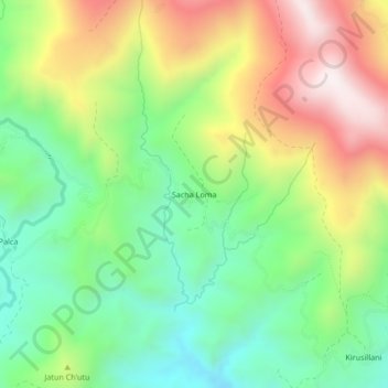
Name: Sacha Loma topographic map, elevation, terrain.
Location: Sacha Loma, Municipio Alalay, Mizque, Cochabamba, Bolivia (-17.78590 -65.59301 -17.74590 -65.55301)
Average elevation: 11,388 ft
Minimum elevation: 10,262 ft
Maximum elevation: 13,035 ft