
Sierra de San Juan topographic map
Interactive map
Click on the map to display elevation.
About this map
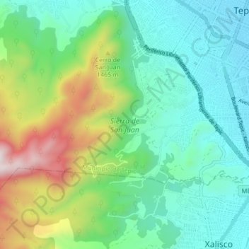
Name: Sierra de San Juan topographic map, elevation, terrain.
Average elevation: 4,042 ft
Minimum elevation: 3,031 ft
Maximum elevation: 6,709 ft
Other topographic maps
Click on a map to view its topography, its elevation and its terrain.
El Aguacate
México > Nayarit > El Aguacate
El Aguacate, Ixtlán del Río, Nayarit, México
Average elevation: 3,589 ft
El Aguacate
México > Nayarit > El Aguacate
El Aguacate, Municipio de Tepic, Nayarit, 63507, México
Average elevation: 3,570 ft