
Langley topographic map
Interactive map
Click on the map to display elevation.
About this map
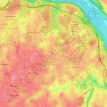
Name: Langley topographic map, elevation, terrain.
Location: Langley, Fairfax County, Virginia, VA 22101, United States (38.92650 -77.17887 38.96650 -77.13887)
Average elevation: 230 ft
Minimum elevation: 23 ft
Maximum elevation: 325 ft
Other topographic maps
Click on a map to view its topography, its elevation and its terrain.
Walter Heights
United States > Virginia > Langley > Walter Heights
Walter Heights, Langley, Fairfax County, Virginia, 22101, United States
Average elevation: 246 ft