
Yichun City topographic map
Interactive map
Click on the map to display elevation.
About this map
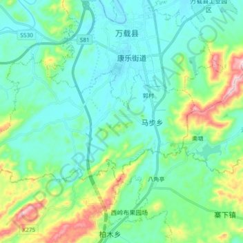
Name: Yichun City topographic map, elevation, terrain.
Location: Mabu, Wanzai County, Yichun City, Jiangxi, China (28.02411 114.33549 28.09698 114.48331)
Average elevation: 581 ft
Minimum elevation: 256 ft
Maximum elevation: 1,759 ft
Other topographic maps
Click on a map to view its topography, its elevation and its terrain.
Yichun City
China > Jiangxi > Yichun City
Sanyang, Yuanzhou District, Yichun City, Jiangxi, China
Average elevation: 541 ft