
Tarnagulla topographic map
Interactive map
Click on the map to display elevation.
About this map
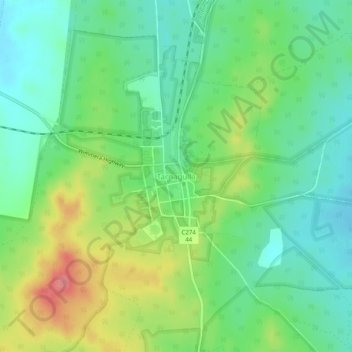
Name: Tarnagulla topographic map, elevation, terrain.
Location: Tarnagulla, Shire of Loddon, Victoria, Australia (-36.78924 143.81147 -36.74924 143.85147)
Average elevation: 686 ft
Minimum elevation: 584 ft
Maximum elevation: 873 ft