Geolocate

Swaffham topographic map

Click on the map to display elevation.

About this map

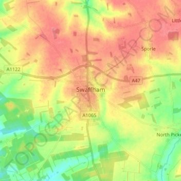
Name: Swaffham topographic map, elevation, terrain.

Location: Swaffham, Breckland District, Norfolk, England, United Kingdom (52.62219 0.61128 52.67286 0.74237)

Average elevation: 200 ft

Minimum elevation: 82 ft

Maximum elevation: 299 ft

Gear up for your next adventure:

🚗GPS Dash Cams - Record your scenic drives through mountain passes and canyons
Camping Coffee Makers - Enjoy premium coffee at the summit or campsite
📌Outdoor GPS Map App - Apps and devices for digital topographic navigation
🏔️Mountain Trail Maps - High‑detail maps for popular peaks
🧭Outdoor Navigation Book - Learn advanced navigation skills

As an Amazon Associate, this site earns from qualifying purchases at no extra cost to you.