
malegaon topographic map
Interactive map
Click on the map to display elevation.
About this map
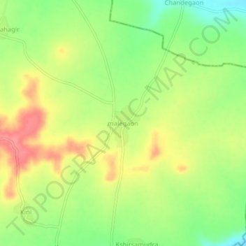
Name: malegaon topographic map, elevation, terrain.
Location: malegaon, Deglur, Nanded, Maharashtra, India (18.39160 77.51085 18.43160 77.55085)
Average elevation: 1,444 ft
Minimum elevation: 1,312 ft
Maximum elevation: 1,578 ft
Other topographic maps
Click on a map to view its topography, its elevation and its terrain.
Degloor
India > Maharashtra > Deglur
Degloor, Deglur, Nanded, Maharashtra, 431717, India
Average elevation: 1,227 ft