
Checca topographic map
Interactive map
Click on the map to display elevation.
About this map
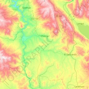
Name: Checca topographic map, elevation, terrain.
Location: Checca, Canas, Cuzco, Perú (-14.62217 -71.65181 -14.38085 -71.35051)
Average elevation: 13,435 ft
Minimum elevation: 11,755 ft
Maximum elevation: 15,472 ft