
Tarsouat topographic map
Interactive map
Click on the map to display elevation.
About this map
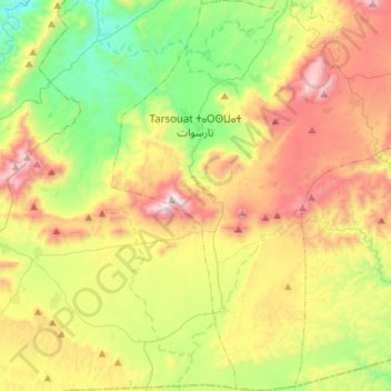
Name: Tarsouat topographic map, elevation, terrain.
Average elevation: 4,409 ft
Minimum elevation: 2,621 ft
Maximum elevation: 7,014 ft
Other topographic maps
Click on a map to view its topography, its elevation and its terrain.
Izerbi
Maroc > cercle de Tafraout > Tarsouat
Izerbi, Tarsouat, caïdat d'Ammelne, cercle de Tafraout, Province de Tiznit, Souss-Massa, Maroc
Average elevation: 4,334 ft