
Mickleham topographic map
Interactive map
Click on the map to display elevation.
About this map
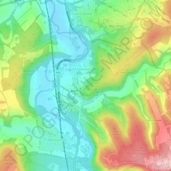
Name: Mickleham topographic map, elevation, terrain.
Average elevation: 338 ft
Minimum elevation: 105 ft
Maximum elevation: 712 ft
Other topographic maps
Click on a map to view its topography, its elevation and its terrain.
Leatherhead
United Kingdom > England > Surrey > Mole Valley
Leatherhead, Mole Valley, Surrey, England, United Kingdom
Average elevation: 177 ft