
Barragem de Odivelas topographic map
Interactive map
Click on the map to display elevation.
About this map
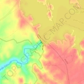
Name: Barragem de Odivelas topographic map, elevation, terrain.
Average elevation: 322 ft
Minimum elevation: 174 ft
Maximum elevation: 387 ft
Other topographic maps
Click on a map to view its topography, its elevation and its terrain.
Santa Margarida do Sado
Portugal > Beja > Ferreira do Alentejo > Santa Margarida do Sado
Santa Margarida do Sado, Figueira dos Cavaleiros, Ferreira do Alentejo, Beja, 7900-304, Portugal
Average elevation: 157 ft