Geolocate

Kōya topographic map

Click on the map to display elevation.

About this map
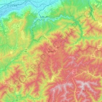
Name: Kōya topographic map, elevation, terrain.

Location: Kōya, Ito County, Wakayama Prefecture, Japan (34.15431 135.51227 34.27827 135.73020)

Average elevation: 1,962 ft

Minimum elevation: 138 ft

Maximum elevation: 3,976 ft

Gear up for your next adventure:

📚USA Hiking Guide Books - Top trail guides and map books
🛏️Cold Weather Sleeping Bag - Warm sleeping bag for cold conditions
📷Action Camera - Capture your outdoor adventures in HD
🛡️Bear Spray Outdoor - Protection in bear country hikes
🪶LED Camping Lantern - Bright lantern for camp lighting

As an Amazon Associate, this site earns from qualifying purchases at no extra cost to you.