
Thank you for supporting this site ❤️
Make a donation
Make a donation
Gear up for your next adventure:
As an Amazon Associate, this site earns from qualifying purchases at no extra cost to you.
Timotes topographic map
Click on the map to display elevation.
Thank you for supporting this site ❤️
Make a donation
Make a donation
Gear up for your next adventure:
As an Amazon Associate, this site earns from qualifying purchases at no extra cost to you.
About this map
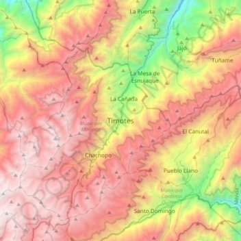
Name: Timotes topographic map, elevation, terrain.
Location: Timotes, Parroquia Miranda, Municipio Miranda, Venezuela (8.82111 -70.90027 9.14111 -70.58027)
Average elevation: 9,613 ft
Minimum elevation: 3,389 ft
Maximum elevation: 15,033 ft
Thank you for supporting this site ❤️
Make a donation
Make a donation
Gear up for your next adventure:
As an Amazon Associate, this site earns from qualifying purchases at no extra cost to you.