Geolocate

Legleg topographic map

Click on the map to display elevation.

About this map

Name: Legleg topographic map, elevation, terrain.

Location: Legleg, San Juan, La Union, Ilocos Region, 2514, Philippines (16.67902 120.35674 16.71902 120.39674)

Average elevation: 157 ft

Minimum elevation: 7 ft

Maximum elevation: 741 ft

Other topographic maps

Click on a map to view its topography, its elevation and its terrain.
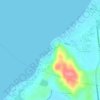
Urbiztondo Beach

Philippines > La Union > San Juan

Average elevation: 43 ft

Gear up for your next adventure:

👟Men's Trail Runners - Lightweight footwear for fast-paced exploration and light hiking
🧥Waterproof Jacket for Hiking - Breathable and rugged rain jacket for outdoor excursions
📷Action Cameras - Rugged cameras to document your journeys across rugged terrain
🎒Trail Energy Bars - High‑calorie bars for hiking energy
🪶Paracord Bracelet - Survival bracelet with built‑in tools

As an Amazon Associate, this site earns from qualifying purchases at no extra cost to you.