Geolocate

Rampur topographic map

Click on the map to display elevation.

About this map

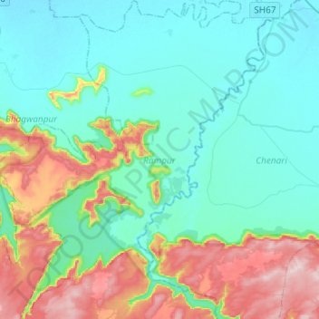
Name: Rampur topographic map, elevation, terrain.

Location: Rampur, Kaimur (Bhabua), Bihar, India (24.78054 83.62810 24.99983 83.81884)

Average elevation: 587 ft

Minimum elevation: 282 ft

Maximum elevation: 1,496 ft

Gear up for your next adventure:

🛏️Cold Weather Sleeping Bag - Warm sleeping bag for cold conditions
📡Handheld GPS Device - Reliable handheld GPS for outdoor navigation
🏫Relief Map Kits - Hands-on tools for teaching landforms and elevation
🛠️Outdoor Gear Repair Kit - Essential tools to fix gear on the trail
🔭Stargazing Telescopes - Perfect for camping in low-light pollution areas shown on maps

As an Amazon Associate, this site earns from qualifying purchases at no extra cost to you.