Geolocate

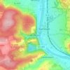
Triefenstein topographic map

Click on the map to display elevation.

About this map

Name: Triefenstein topographic map, elevation, terrain.

Location: Triefenstein, Landkreis Main-Spessart, Bavaria, 97855, Germany (49.77483 9.54496 49.83284 9.65466)

Average elevation: 738 ft

Minimum elevation: 443 ft

Maximum elevation: 1,112 ft

Other topographic maps

Click on a map to view its topography, its elevation and its terrain.
Mühlbach

Germany > Bavaria > Landkreis Main-Spessart > Karlstadt

Average elevation: 761 ft

Gear up for your next adventure:

🔦Powerful Headlamps - Ultra-bright hands-free lighting for night navigation
🪶Compact Camp Shovel - Folding shovel for campsite tasks
🧦Hiking Socks - Comfortable socks to prevent blisters on long hikes
🗺️Topographic Maps - Detailed topo maps for hiking, exploring and outdoor navigation
🔌Solar Panel Charger - Charge gear sustainably outdoors

As an Amazon Associate, this site earns from qualifying purchases at no extra cost to you.