
Mechtras topographic map
Interactive map
Click on the map to display elevation.
About this map
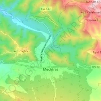
Name: Mechtras topographic map, elevation, terrain.
Location: Mechtras, Daïra Boghni, Tizi Ouzou, 15042, Algérie (36.53117 3.96509 36.57582 4.02940)
Average elevation: 1,434 ft
Minimum elevation: 755 ft
Maximum elevation: 2,582 ft
Other topographic maps
Click on a map to view its topography, its elevation and its terrain.
Boghni
Algérie > Tizi Ouzou > Daïra Boghni
Boghni, Daïra Boghni, Tizi Ouzou, 15003, Algérie
Average elevation: 2,110 ft