
Constitution Hill topographic map
Interactive map
Click on the map to display elevation.
About this map
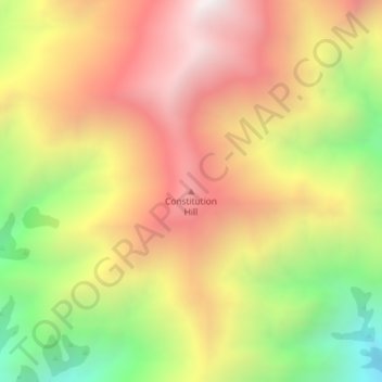
Name: Constitution Hill topographic map, elevation, terrain.
Location: Constitution Hill, Kaikōura, Canterbury, New Zealand (-42.09083 173.54478 -42.09073 173.54488)
Average elevation: 5,138 ft
Minimum elevation: 2,851 ft
Maximum elevation: 7,054 ft
Other topographic maps
Click on a map to view its topography, its elevation and its terrain.
Mount Fyffe
New Zealand > Canterbury > Kaikoura
Mount Fyffe, Kaikōura, Canterbury, New Zealand
Average elevation: 3,747 ft
Kaikoura
New Zealand > Canterbury > Kaikoura
Kaikoura, Kaikōura District, Canterbury, 7300, New Zealand
Average elevation: 49 ft