Geolocate

Tekirdağ topographic map

Click on the map to display elevation.

About this map
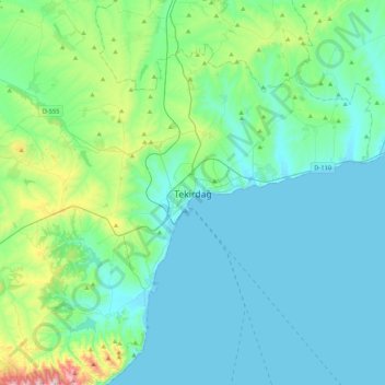
Name: Tekirdağ topographic map, elevation, terrain.

Location: Tekirdağ, Süleymanpaşa, Tekirdağ, Marmara Region, 59200, Turkey (40.81812 27.35078 41.13812 27.67078)

Average elevation: 358 ft

Minimum elevation: -3 ft

Maximum elevation: 2,323 ft

Other topographic maps

Click on a map to view its topography, its elevation and its terrain.

Husunlu Mahallesi

Turkey > Süleymanpaşa

Average elevation: 344 ft

Gear up for your next adventure:

🧥Waterproof Jacket for Hiking - Breathable and rugged rain jacket for outdoor excursions
🥾Men's Hiking Boots - Durable, waterproof footwear for rugged terrain and steep inclines
🧭Orienteering Set - Complete compass and map reading kit
🧣Hiking Neck Gaiter - Multi‑use neck protection for outdoor weather
🗻Climbing Gear Basics - Essential gear for beginner climbers

As an Amazon Associate, this site earns from qualifying purchases at no extra cost to you.