
Druesberg topographic map
Interactive map
Click on the map to display elevation.
About this map
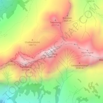
Name: Druesberg topographic map, elevation, terrain.
Location: Druesberg, Muotathal, Schwyz, 6436, Switzerland (47.00420 8.83364 47.00430 8.83374)
Average elevation: 5,669 ft
Minimum elevation: 3,619 ft
Maximum elevation: 7,444 ft