
Jhelum topographic map
Interactive map
Click on the map to display elevation.
About this map
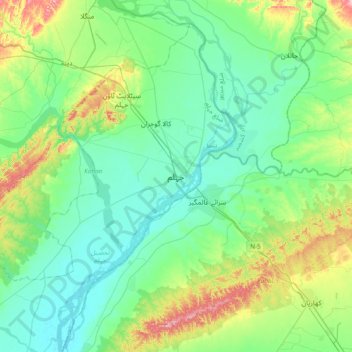
Name: Jhelum topographic map, elevation, terrain.
Average elevation: 863 ft
Minimum elevation: 709 ft
Maximum elevation: 1,362 ft
Other topographic maps
Click on a map to view its topography, its elevation and its terrain.
Hattar
Pakistan > Punjab > Jhelum District
Hattar, Pind Dadan Khan Tehsil, Jhelum District, Punjab, Pakistan
Average elevation: 659 ft