
William E. Wolfe Park topographic map
Interactive map
Click on the map to display elevation.
About this map
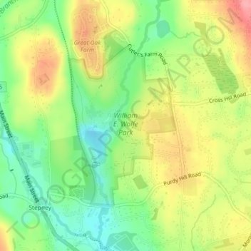
Name: William E. Wolfe Park topographic map, elevation, terrain.
Average elevation: 423 ft
Minimum elevation: 272 ft
Maximum elevation: 597 ft
Other topographic maps
Click on a map to view its topography, its elevation and its terrain.
Great Hollow Lake
United States > Connecticut > Greater Bridgeport Planning Region > Monroe > Stepney
Great Hollow Lake, Stepney, Monroe, Greater Bridgeport Planning Region, Connecticut, United States
Average elevation: 413 ft