Geolocate

Ongallur topographic map

Click on the map to display elevation.

About this map

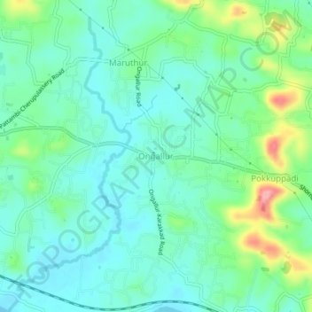
Name: Ongallur topographic map, elevation, terrain.

Location: Ongallur, Pattambi, Palakkad District, Kerala, 679313, India (10.78285 76.19862 10.82285 76.23862)

Average elevation: 135 ft

Minimum elevation: 39 ft

Maximum elevation: 404 ft

Other topographic maps

Click on a map to view its topography, its elevation and its terrain.

Pattambi

India > Kerala > Pattambi

Average elevation: 125 ft

Gear up for your next adventure:

🧣Hiking Neck Gaiter - Multi‑use neck protection for outdoor weather
🧣Merino Neck Gaiters - Multi-functional headwear for wind and sun protection
🦶Hiking Gaiters - Keep debris and water out of your boots
🔭Compact Binoculars - HD vision for scouting terrain and identifying distant landmarks
☀️Outdoor Sunscreen - High protection sunscreen for outdoor activities

As an Amazon Associate, this site earns from qualifying purchases at no extra cost to you.