
Gillette Castle State Park topographic map
Interactive map
Click on the map to display elevation.
About this map
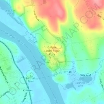
Name: Gillette Castle State Park topographic map, elevation, terrain.
Average elevation: 108 ft
Minimum elevation: 3 ft
Maximum elevation: 348 ft
Other topographic maps
Click on a map to view its topography, its elevation and its terrain.
Tiffany Hill Corner
USA > Connecticut > Tiffany Hill Corner
Tiffany Hill Corner, Middlesex County, Connecticut, 06439, USA
Average elevation: 217 ft