
Buckeye topographic map
Interactive map
Click on the map to display elevation.
About this map
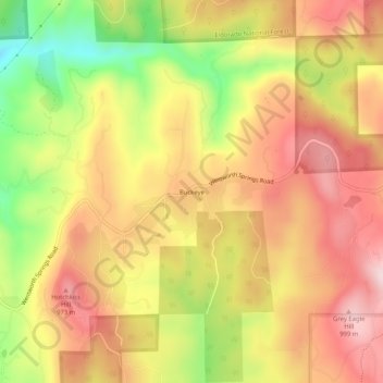
Name: Buckeye topographic map, elevation, terrain.
Location: Buckeye, El Dorado County, California, 95634, USA (38.90379 -120.81799 38.94379 -120.77799)
Average elevation: 2,861 ft
Minimum elevation: 2,205 ft
Maximum elevation: 3,337 ft