
Cunas topographic map
Interactive map
Click on the map to display elevation.
About this map
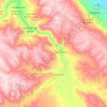
Name: Cunas topographic map, elevation, terrain.
Location: Cunas, Yanacancha, Chupaca, Junín, Perú (-12.25462 -75.49496 -12.07693 -75.37243)
Average elevation: 13,504 ft
Minimum elevation: 10,705 ft
Maximum elevation: 15,102 ft
Other topographic maps
Click on a map to view its topography, its elevation and its terrain.
Provincia de Chupaca
Perú > Junín > Yanacancha
Provincia de Chupaca, Yanacancha, Chupaca, Junín, Perú
Average elevation: 13,153 ft