
Plate topographic map
Interactive map
Click on the map to display elevation.
About this map
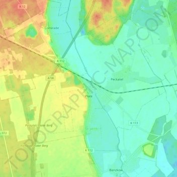
Name: Plate topographic map, elevation, terrain.
Average elevation: 174 ft
Minimum elevation: 108 ft
Maximum elevation: 243 ft
Other topographic maps
Click on a map to view its topography, its elevation and its terrain.
Rampe
Allemagne > Mecklembourg-Poméranie-Occidentale > Ludwigslust-Parchim
Rampe, Leezen, Crivitz, Ludwigslust-Parchim, Mecklembourg-Poméranie-Occidentale, 19067, Allemagne
Average elevation: 148 ft
Parchim
Allemagne > Mecklembourg-Poméranie-Occidentale > Ludwigslust-Parchim > Parchim
Parchim, Ludwigslust-Parchim, Mecklembourg-Poméranie-Occidentale, Allemagne
Average elevation: 200 ft