
Wedringen topographic map
Interactive map
Click on the map to display elevation.
About this map
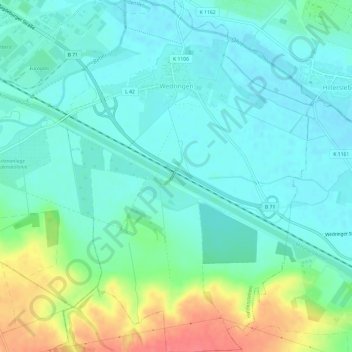
Name: Wedringen topographic map, elevation, terrain.
Location: Wedringen, Haldensleben, Börde, Sachsen-Anhalt, Deutschland (52.24507 11.44635 52.28157 11.48881)
Average elevation: 207 ft
Minimum elevation: 154 ft
Maximum elevation: 351 ft