
Finnentrop topographic map
Interactive map
Click on the map to display elevation.
About this map
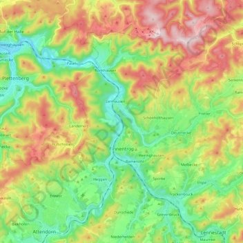
Name: Finnentrop topographic map, elevation, terrain.
Average elevation: 1,247 ft
Minimum elevation: 663 ft
Maximum elevation: 2,129 ft
Other topographic maps
Click on a map to view its topography, its elevation and its terrain.
Olpe
Allemagne > Rhénanie-du-Nord-Westphalie > Kreis Olpe
Olpe, Kreis Olpe, Rhénanie-du-Nord-Westphalie, 57462, Allemagne
Average elevation: 1,312 ft