
Guimarei topographic map
Interactive map
Click on the map to display elevation.
About this map
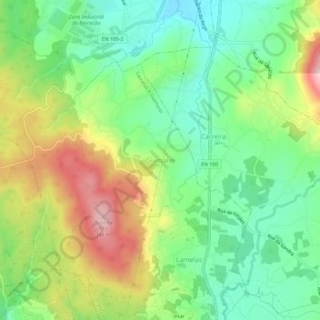
Name: Guimarei topographic map, elevation, terrain.
Location: Guimarei, Santo Tirso, Porto, 4825-241, Portugal (41.27995 -8.49921 41.31995 -8.45921)
Average elevation: 627 ft
Minimum elevation: 302 ft
Maximum elevation: 1,152 ft
Other topographic maps
Click on a map to view its topography, its elevation and its terrain.