
Reșița topographic map
Interactive map
Click on the map to display elevation.
About this map
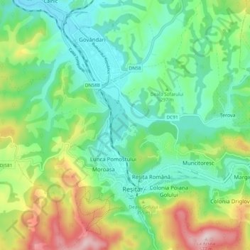
Name: Reșița topographic map, elevation, terrain.
Location: Reșița, Caraș-Severin, Romania (45.27843 21.85963 45.33296 21.95315)
Average elevation: 1,007 ft
Minimum elevation: 633 ft
Maximum elevation: 1,834 ft
Other topographic maps
Click on a map to view its topography, its elevation and its terrain.