
Byhalia topographic map
Interactive map
Click on the map to display elevation.
About this map
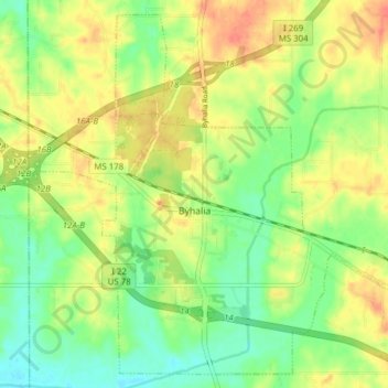
Name: Byhalia topographic map, elevation, terrain.
Location: Byhalia, Marshall County, Mississippi, 38611, United States (34.84547 -89.72391 34.90438 -89.64650)
Average elevation: 364 ft
Minimum elevation: 289 ft
Maximum elevation: 443 ft
Other topographic maps
Click on a map to view its topography, its elevation and its terrain.
Wall Doxey State Park
United States > Mississippi > Marshall County
Wall Doxey State Park, Marshall County, Mississippi, United States
Average elevation: 430 ft
Holly Springs
United States > Mississippi > Marshall County
Holly Springs, Marshall County, Mississippi, United States
Average elevation: 538 ft
Victoria
United States > Mississippi > Marshall County > Victoria
Victoria, Marshall County, Mississippi, 38679, United States
Average elevation: 436 ft