
Bonnefont topographic map
Interactive map
Click on the map to display elevation.
About this map
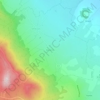
Name: Bonnefont topographic map, elevation, terrain.
Average elevation: 3,615 ft
Minimum elevation: 3,169 ft
Maximum elevation: 4,675 ft
Other topographic maps
Click on a map to view its topography, its elevation and its terrain.
Mont Devès
France > Auvergne-Rhône-Alpes > Haute-Loire > Séneujols
Mont Devès, Séneujols, Le Puy-en-Velay, Haute-Loire, Auvergne-Rhône-Alpes, France métropolitaine, 43510, France
Average elevation: 4,163 ft