
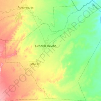
General Treviño topographic map
Interactive map
Click on the map to display elevation.
About this map
Name: General Treviño topographic map, elevation, terrain.
Location: General Treviño, Nuevo León, México (26.09389 -99.58993 26.32927 -99.33241)
Average elevation: 551 ft
Minimum elevation: 341 ft
Maximum elevation: 906 ft
Other topographic maps
Click on a map to view its topography, its elevation and its terrain.
San Javier
México > Nuevo León > General Treviño
San Javier, General Treviño, Nuevo León, México
Average elevation: 456 ft