Geolocate

Suances topographic map

Click on the map to display elevation.

About this map

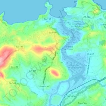
Name: Suances topographic map, elevation, terrain.

Location: Suances, Besaya, Cantabria, Spain (43.38287 -4.09780 43.44505 -4.01489)

Average elevation: 128 ft

Minimum elevation: -23 ft

Maximum elevation: 607 ft

Gear up for your next adventure:

🎁Geography Themed Gifts - Unique gift ideas for map lovers and geography enthusiasts
🪶Wildlife Field Guides - Learn animal tracking and species ID
📚USA Hiking Guide Books - Top trail guides and map books
🚑Emergency Bivvies - Heat-reflective sleeping bags for survival situations
🌎3D Topographic Globes - Raised relief globes for a tactile understanding of geography

As an Amazon Associate, this site earns from qualifying purchases at no extra cost to you.