
Osterscheps topographic map
Interactive map
Click on the map to display elevation.
About this map
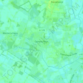
Name: Osterscheps topographic map, elevation, terrain.
Average elevation: 20 ft
Minimum elevation: 7 ft
Maximum elevation: 39 ft
Other topographic maps
Click on a map to view its topography, its elevation and its terrain.
Wildenloh
Deutschland > Niedersachsen > Landkreis Ammerland > Edewecht
Wildenloh, Edewecht, Landkreis Ammerland, Niedersachsen, 26188, Deutschland
Average elevation: 23 ft
Jeddeloh II
Deutschland > Niedersachsen > Landkreis Ammerland > Edewecht
Jeddeloh II, Edewecht, Landkreis Ammerland, Niedersachsen, 26188, Deutschland
Average elevation: 26 ft
Klein Scharrel
Deutschland > Niedersachsen > Landkreis Ammerland > Edewecht
Klein Scharrel, Edewecht, Landkreis Ammerland, Niedersachsen, Deutschland
Average elevation: 30 ft
Jeddeloh I
Deutschland > Niedersachsen > Landkreis Ammerland > Edewecht > Jeddeloh I
Jeddeloh I, Edewecht, Landkreis Ammerland, Niedersachsen, 26188, Deutschland
Average elevation: 26 ft
Friedrichsfehn
Deutschland > Niedersachsen > Landkreis Ammerland > Edewecht
Friedrichsfehn, Edewecht, Landkreis Ammerland, Niedersachsen, Deutschland
Average elevation: 30 ft