
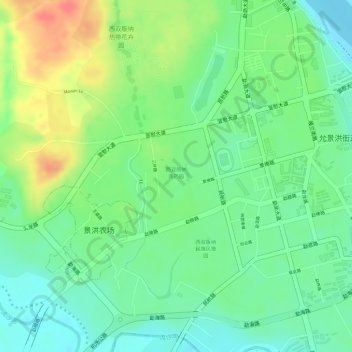
西双版纳南药园 topographic map
Interactive map
Click on the map to display elevation.
About this map
Name: 西双版纳南药园 topographic map, elevation, terrain.
Location: 西双版纳南药园, 允景洪街道, 景洪市, 西双版纳傣族自治州, 云南省, 666100, 中国 (22.00161 100.78644 22.00772 100.79142)
Average elevation: 1,831 ft
Minimum elevation: 1,749 ft
Maximum elevation: 1,946 ft