
Brăila topographic map
Interactive map
Click on the map to display elevation.
About this map
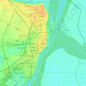
Name: Brăila topographic map, elevation, terrain.
Location: Brăila, Romania (45.23100 27.90853 45.31349 27.99913)
Average elevation: 39 ft
Minimum elevation: 3 ft
Maximum elevation: 102 ft
Other topographic maps
Click on a map to view its topography, its elevation and its terrain.