Geolocate

Franqueira topographic map

Click on the map to display elevation.

About this map

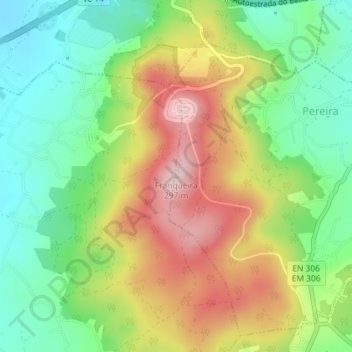
Name: Franqueira topographic map, elevation, terrain.

Location: Franqueira, Barcelos, Braga, 4755-333, Portugal (41.48937 -8.64559 41.48947 -8.64549)

Average elevation: 479 ft

Minimum elevation: 125 ft

Maximum elevation: 958 ft

Other topographic maps

Click on a map to view its topography, its elevation and its terrain.

Arcozelo

Portugal > Braga > Barcelos

Average elevation: 125 ft

Galegos (São Martinho)

Portugal > Braga > Barcelos

Average elevation: 256 ft

Silva

Portugal > Braga > Barcelos

Average elevation: 308 ft

Vilar do Monte

Portugal > Braga > Barcelos

Average elevation: 673 ft

Silva

Portugal > Braga > Barcelos

Average elevation: 308 ft

Abade de Neiva

Portugal > Braga > Barcelos

Average elevation: 358 ft

Arcozelo

Portugal > Braga > Barcelos

Average elevation: 125 ft

Fragoso

Portugal > Braga > Barcelos

Average elevation: 571 ft

Tamel (Santa Leocádia)

Portugal > Braga > Barcelos

Average elevation: 814 ft

Areias de Vilar

Portugal > Braga > Barcelos

Average elevation: 200 ft

Cristelo

Portugal > Braga > Barcelos

Average elevation: 135 ft

Roriz

Portugal > Braga > Barcelos

Average elevation: 223 ft

Gear up for your next adventure:

🌡️Portable Weather Meter - Track weather conditions on the trail
🛌Ultralight Sleeping Bags - Compact down bags for cold nights in the wilderness
🎒Outdoor Daypacks - Lightweight backpacks designed for carrying maps and essential gear
🛰️Satellite Messengers - Emergency SOS and two-way messaging for off-grid adventures
📶Vehicle Signal Boosters - Improve reception in rural areas while driving to trailheads

As an Amazon Associate, this site earns from qualifying purchases at no extra cost to you.