
Gioux topographic map
Interactive map
Click on the map to display elevation.
About this map
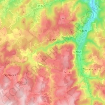
Name: Gioux topographic map, elevation, terrain.
Average elevation: 2,470 ft
Minimum elevation: 1,762 ft
Maximum elevation: 3,002 ft
La commune culmine, au nord-est du bourg de Gioux, à 886 mètres, au puy d'Hyverneresse, à proximité du hameau du même nom, tel qu'il apparaît sur une carte du fond topographique IGN au 1/25000