
Thank you for supporting this site ❤️
Make a donation
Make a donation
Gear up for your next adventure:
As an Amazon Associate, this site earns from qualifying purchases at no extra cost to you.
Empoli topographic map
Click on the map to display elevation.
Thank you for supporting this site ❤️
Make a donation
Make a donation
Gear up for your next adventure:
As an Amazon Associate, this site earns from qualifying purchases at no extra cost to you.
About this map
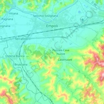
Name: Empoli topographic map, elevation, terrain.
Location: Empoli, Metropolitan City of Florence, Tuscany, 50053, Italy (43.65080 10.87704 43.74125 11.00447)
Average elevation: 190 ft
Minimum elevation: 43 ft
Maximum elevation: 735 ft
Thank you for supporting this site ❤️
Make a donation
Make a donation
Gear up for your next adventure:
As an Amazon Associate, this site earns from qualifying purchases at no extra cost to you.