
Shelbyville topographic map
Interactive map
Click on the map to display elevation.
About this map
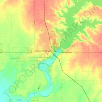
Name: Shelbyville topographic map, elevation, terrain.
Location: Shelbyville, Shelby County, Illinois, 62565, United States (39.36643 -88.83007 39.44643 -88.75007)
Average elevation: 620 ft
Minimum elevation: 525 ft
Maximum elevation: 696 ft
Other topographic maps
Click on a map to view its topography, its elevation and its terrain.
Shelbyville
United States > Illinois > Shelby County > Shelbyville
Shelbyville, Shelby County, Illinois, 62565, United States
Average elevation: 627 ft