
Barrow Hollin topographic map
Interactive map
Click on the map to display elevation.
About this map
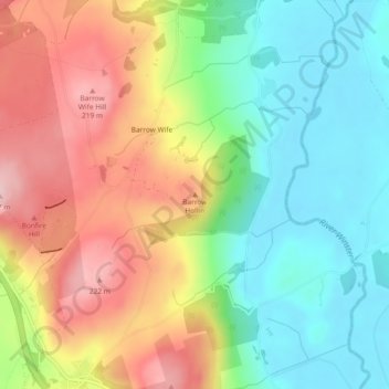
Name: Barrow Hollin topographic map, elevation, terrain.
Average elevation: 331 ft
Minimum elevation: 3 ft
Maximum elevation: 768 ft
Other topographic maps
Click on a map to view its topography, its elevation and its terrain.
Lakes
United Kingdom > England > Cumbria > South Lakeland > Elterwater
Lakes, Elterwater, South Lakeland, Cumbria, England, United Kingdom
Average elevation: 1,070 ft
Kendal
United Kingdom > England > Cumbria > South Lakeland
Kendal, South Lakeland, Cumbria, England, United Kingdom
Average elevation: 367 ft
Tarn Hows
United Kingdom > England > Cumbria > South Lakeland > Hawkshead
Tarn Hows, Hawkshead, South Lakeland, Cumbria, North West England, England, United Kingdom
Average elevation: 614 ft