
Mamainse Harbour topographic map
Interactive map
Click on the map to display elevation.
About this map
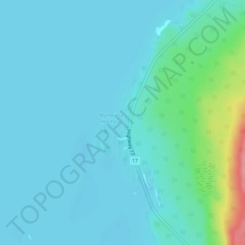
Name: Mamainse Harbour topographic map, elevation, terrain.
Average elevation: 630 ft
Minimum elevation: 581 ft
Maximum elevation: 906 ft
Other topographic maps
Click on a map to view its topography, its elevation and its terrain.
String Lake
Canada > Ontario > Unorganized North Algoma
String Lake, Highway 101, Unorganized North Algoma, Algoma District, Ontario, Canada
Average elevation: 1,644 ft