
Zielona Góra topographic map
Interactive map
Click on the map to display elevation.
About this map
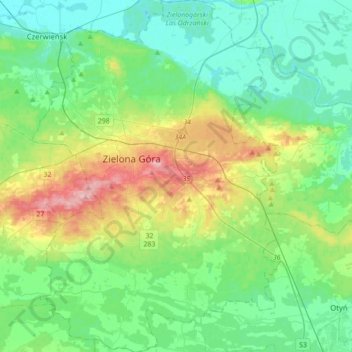
Name: Zielona Góra topographic map, elevation, terrain.
Location: Zielona Góra, Lubusz Voivodeship, Poland (51.82017 15.40595 52.03511 15.65243)
Average elevation: 285 ft
Minimum elevation: 138 ft
Maximum elevation: 702 ft