
Ghoufi topographic map
Interactive map
Click on the map to display elevation.
About this map
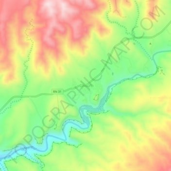
Name: Ghoufi topographic map, elevation, terrain.
Location: Ghoufi, Daïra de T'Kout, Batna, 05270, Algérie (35.03936 6.14809 35.07936 6.18809)
Average elevation: 2,566 ft
Minimum elevation: 1,998 ft
Maximum elevation: 3,173 ft