
Gerolding topographic map
Interactive map
Click on the map to display elevation.
About this map
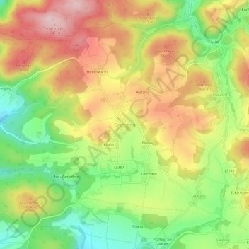
Name: Gerolding topographic map, elevation, terrain.
Location: Gerolding, Bezirk Melk, Lower Austria, 3392, Austria (48.23091 15.40158 48.27091 15.44158)
Average elevation: 1,332 ft
Minimum elevation: 899 ft
Maximum elevation: 1,765 ft