
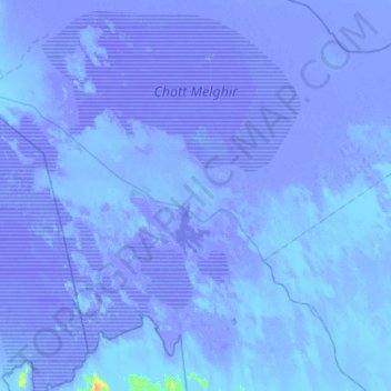
Schott Melghir topographic map
Interactive map
Click on the map to display elevation.
About this map
Name: Schott Melghir topographic map, elevation, terrain.
Location: Schott Melghir, CW 301, المغير, دائرة المغير, المغير, Algerien (33.85978 5.93099 34.33387 6.46288)
Average elevation: -75 ft
Minimum elevation: -108 ft
Maximum elevation: 62 ft