
Mandaio topographic map
Interactive map
Click on the map to display elevation.
About this map
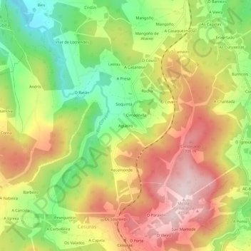
Name: Mandaio topographic map, elevation, terrain.
Location: Mandaio, Agüeiro, Betanzos, A Coruña, Galicië, 15390, Spanje (43.17128 -8.22035 43.21128 -8.18035)
Average elevation: 866 ft
Minimum elevation: 289 ft
Maximum elevation: 1,427 ft