
Mount Mariveles topographic map
Interactive map
Click on the map to display elevation.
About this map
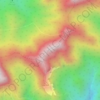
Name: Mount Mariveles topographic map, elevation, terrain.
Average elevation: 3,022 ft
Minimum elevation: 1,663 ft
Maximum elevation: 4,108 ft
Other topographic maps
Click on a map to view its topography, its elevation and its terrain.
Cabog-cabog
Philippines > Bataan > Balanga
Cabog-cabog, Balanga, Bataan, Central Luzon, Philippines
Average elevation: 456 ft
Bagong Silang
Philippines > Bataan > Balanga
Bagong Silang, Balanga, Bataan, Central Luzon, 2101, Philippines
Average elevation: 125 ft